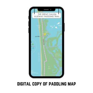
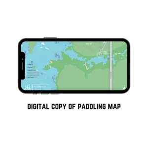
Experience the unspoiled coastal beauty of Don Pedro Island State Park with this free downloadable paddle map. Located off Florida’s Gulf Coast, Don Pedro Island is renowned for its pristine beaches, mangrove forests, and vibrant marine life. This paddle map will guide you through some of the most scenic kayak or paddle boarding routes, complete with launch sites, wildlife highlights, and tips tailored to the area’s tidal conditions.
Discover Don Pedro Island State Park
Stretching between Knight Island and Little Gasparilla Island, Don Pedro Island State Park offers a relaxing escape from crowded beaches, giving you a chance to spot dolphins, manatees, and a variety of bird species along your route. For more information on park hours and amenities—or to learn about the island’s history, conservation efforts, and upcoming events—visit the official Florida State Parks website.
Experience the natural beauty of Don Pedro Island State Park like never before! You’ll have everything you need to explore this stunning coastal gem.
What’s Included
- Detailed Map of Don Pedro Island State Park
- Launch points, shoreline details, waterway markers, and wildlife areas.
- Icons & Quick Tips
- Identifies amenities (restrooms, trails, waterway areas)
- Highlights wildlife viewing opportunities (manatees, birds, dolphins)
- Printable & Mobile-Friendly
- Easily view on your phone or print out before heading to the water.
How to Use this Paddle Map
- Download the PDF directly after checkout (it’s free!).
- Save or Print the map to bring along on your next paddling trip.
- Plan Your Routes: Check out the tides, and plan your route according. View the park hours as the gate closes at 5 PM daily.
- Stay Safe: Always wear a PFD, follow local regulations (SB606), and be mindful of tides and weather conditions.
Why You’ll Love It
- Local Insight: Get to know this Florida State Park’s hidden nooks and prime wildlife-spotting zones.
- Convenient & Free: Instantly accessible, no need to pay or wait for shipping.
- Perfect for Exploring: Whether you’re a beginner looking for a calm kayak route near Englewood or an experienced paddler seeking a scenic day trip, this map has you covered.
Paddle Map Disclaimer & Usage Terms
Copyright & Usage Notice
This Don Pedro Island State Park Paddle Map is provided free of charge for personal, non-commercial use only.
- No Reproduction: You may not copy, distribute, modify, or rebrand these maps for commercial or promotional purposes without express written consent from SUP Englewood.
- Safety Responsibility: Use this map at your own risk. Always follow local regulations, wear proper safety gear, and be mindful of changing conditions. SUP Englewood is not liable for any accidents, injuries, or damages arising from the use of this guide.